
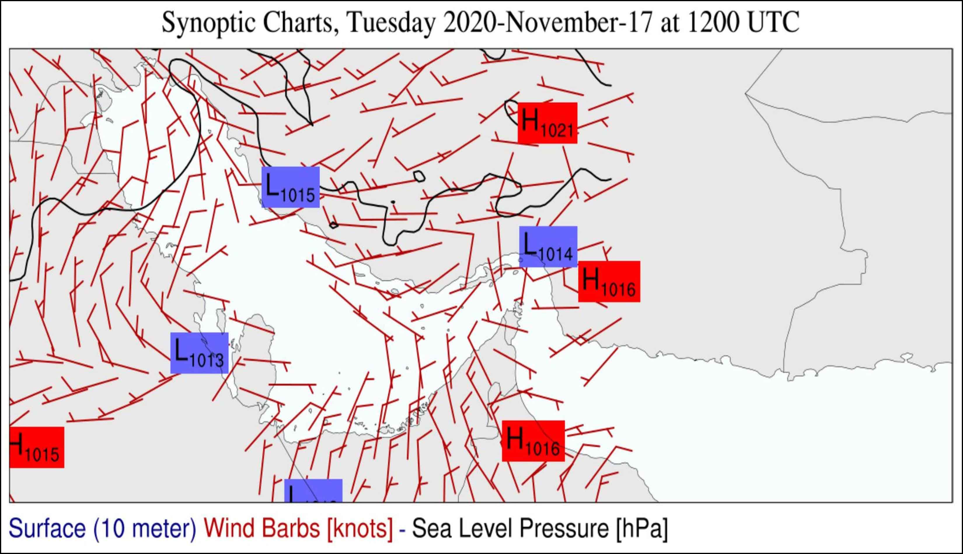
Met-Ocean Forecast-Hindcast System
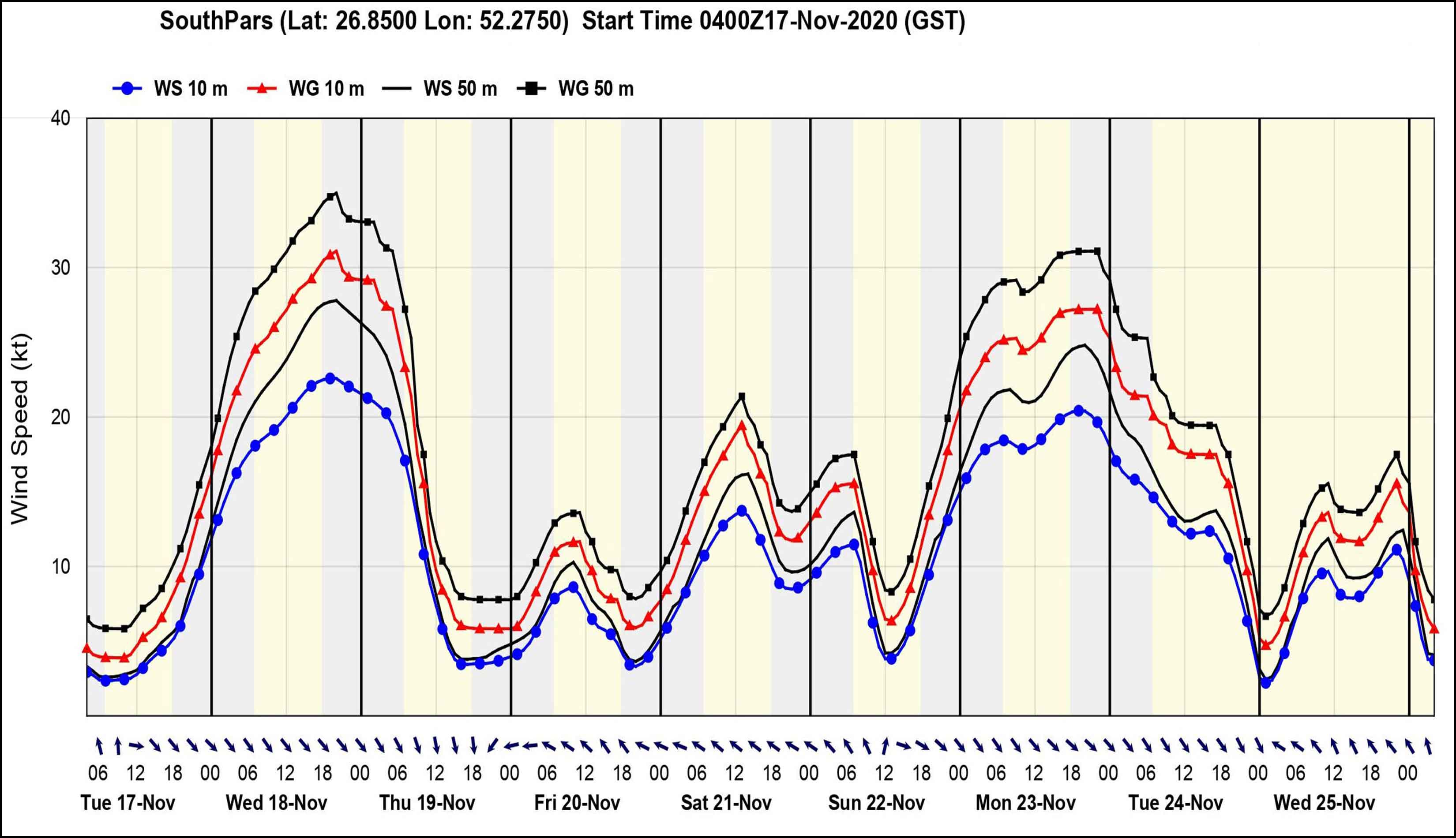
One of the fundamental elements of rapid warning systems and sequential actions in risk management and crisis management is the met-ocean forecast. There has been a significant advancement in the past few years in the study and development of met-ocean forecast parameters, which has improved the delivery of forecasting services and early warning systems in a wholly local manner at Oceans Research Company. Forecasts over the next few minutes to hours are necessary for a variety of operational initiatives. This precise forecasting might involve forecasting the course of dangerous marine storms to issue warnings or calculate the amount of met-ocean changes that will take place in a certain region over the next several hours. Such projections frequently need to be generated every few hours since the regional wind regime changes abruptly and with great speed. In the past, a straightforward extrapolation was used to make forecasts for the coming few hours. However, with the development of mesoscale numerical models, this data can be used in a specialized system to make a more accurate forecast by fusing the met-ocean forecast and local effects found in the area. The combined use of numerical models and remote sensing data from radar and satellite is a technique for met-ocean nowcasting parameters in the area.
Generally speaking, nowcasting largely relies on the forecast team receiving high-accuracy observations in real-time on an integrated display system that is simple for the operations team to use. The integrated system for nowcasting, in progress, as well as forecasting, has been fully natively developed by Oceans Research Co., and users have the opportunity of employing both modes. Nowcasting is the short-term forecast for the atmosphere and ocean, which, according to the World Meteorological Organization, can last up to two hours and up to six hours, respectively. This forecast uses methods like numerical modeling and remote sensing that consider the potential evolution of the atmospheric condition to provide a time estimate for the known met-ocean parameters. The chance of making the error of failing to incorporate local phenomena grows when the modeling period for the next hours and days is extended. As a result, compared to using met-ocean numerical forecast models for longer periods, this form of forecast contains more precise details and has lower inaccuracy. Met-ocean nowcasting is the process of forecasting present wind and wave conditions and forecasting with extrapolation for 0 to 6 hours utilizing data from surface weather stations, wind profiles, and other accessible met-ocean data. Minor occurrences like individual storms may be anticipated rather well throughout this time. Nowcasting is vastly improved by the use of satellite data and field research since opposed to surface weather stations, remote sensing enables our research team to continually and with considerably higher resolution record the size, shape, intensity, speed, and direction of movement of meteorological data.
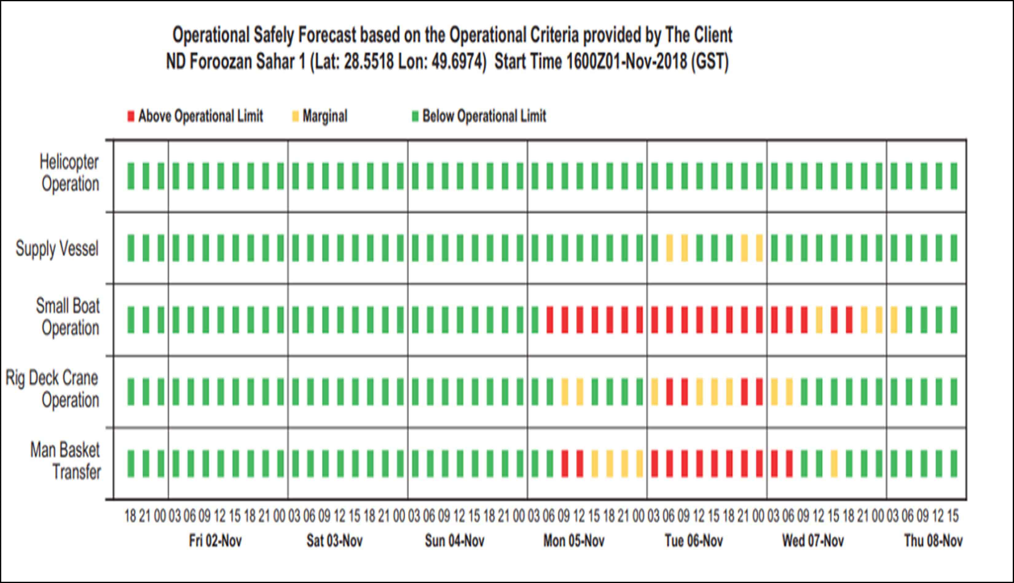
These projections can be given to consumers in a variety of methods, including social networks or emails, which are taken into consideration by reputable companies. The forecast statements that are submitted will, for instance, contain the following:
Met-Ocean Forecast-Hindcast System
Met-Ocean Forecast
Nowcasting
Met-Ocean Forecast Parsi System Services